- ds.. # Relief Visualization Toolbox in Python documentation master file, created by
sphinx-quickstart on Mon Oct 12 08:11:32 2020. You can adapt this file completely to your liking, but it should at least contain the root toctree directive.
Relief Visualization Toolbox
Relief Visualization Toolbox (RVT) was produced to help scientists visualize raster elevation model datasets. We have narrowed down the selection to include techniques that have proven to be effective for identification of small scale features. The default settings therefore assume working with high resolution digital elevation models derived from airborne laser scanning missions (lidar), however RVT methods can also be used for other purposes.
Sky-view factor, for example, can be efficiently used in numerous studies where digital elevation model visualizations and automatic feature extraction techniques are indispensable, e.g. in geography, archaeology, geomorphology, cartography, hydrology, glaciology, forestry and disaster management. It can even be used in engineering applications, such as predicting the availability of the GPS signal in urban areas.
RVT visualization methods
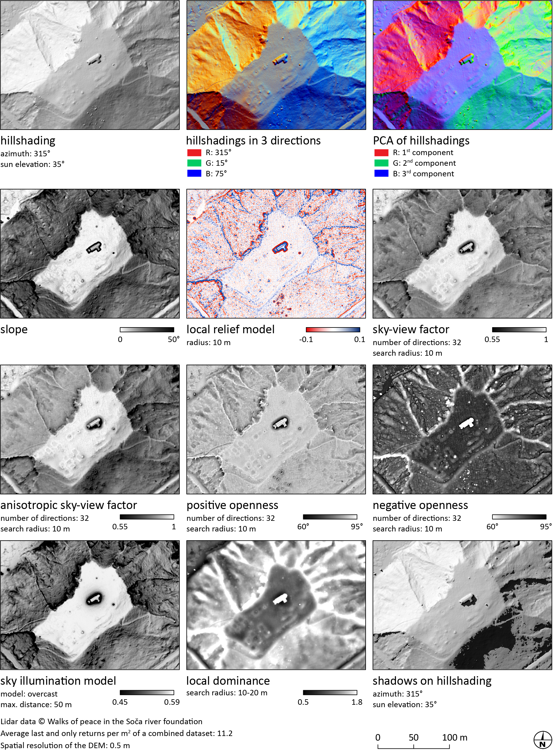
Methods currently implemented are (see also List of visualizations):
hillshading
hillshading from multiple directions
slope gradient
simple local relief model
multi-scale relief model
multi-scale topographic position
sky illumination
sky-view factor (as developed by our team)
anisotropic sky-view factor
local dominance
positive and negative openness
enhanced prismatic openness
visualisation for archaeological topography (VAT)
visualisation for archaeological topography (VAT flat)
combined visualisation for archaeological topography (combined VAT)
enhanced multi-scale topographic position version 3 (e3MSTP)
enhanced multi-scale topographic position version 4 (e4MSTP)
RVT visualisations

RVT combined visualisations
References
When using the tools, please cite:
Zakšek, K., Oštir, K., Kokalj, Ž. 2011. Sky-View Factor as a relief visualization technique. Remote Sensing 3: 398-415.
Kokalj, Ž. 2025. Standardizing visualization in ancient Maya lidar research: Techniques, challenges and recommendations. Archaeological Prospection 32(4): 967-988.
Further reading
Kokalj, Žiga, Ralf Hesse. 2017. Airborne laser scanning raster data visualization: A Guide to Good Practice. Ljubljana: Založba ZRC. (a comparative guide describing each method)
Kokalj, Ž., Somrak, M. 2019. Why not a single image? Combining visualizations to facilitate fieldwork and on-screen mapping. Remote Sensing 11(7): 747. (explanation of blending techniques)
Contributing
The project source code is available at GitHub. Pull requests are welcome. For major changes, please open an issue first to discuss what you would like to change.
Please report any bugs and suggestions for improvements.
Acknowledgment
Development of RVT was part financed by the European Commission’s Culture Programme through the ArchaeoLandscapes Europe project and by the Slovenian Research Agency core funding No. P2-0406, and by research projects No. J2-9251, No. J6-7085 and No. J6-9395.
Development of RVT QGIS plugin was part financed by PTS Consultancy via the UK Government Culture Recovery Fund.
License
This project is licensed under the terms of the Apache License.
© Copyright 2010-2026 ZRC SAZU and University of Ljubljana (UL FGG)